New Paper on Agriculture in Mato Grosso
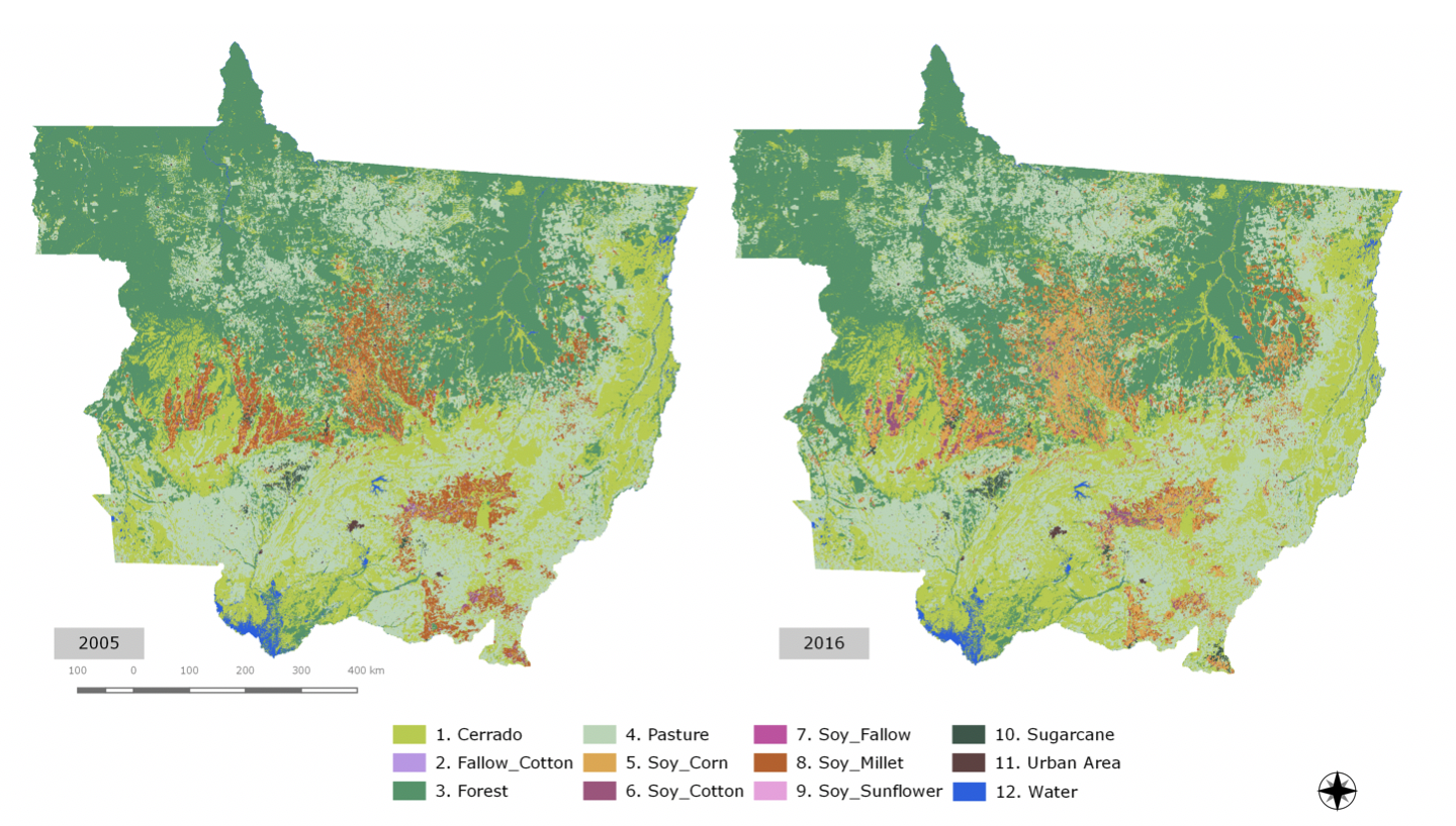
The project team developed innovative methods of using satellite image time series to produce land use and land cover classification for the Mato Grosso state in Brazil from 2001 to 2016 . We used MODIS time series data to classify natural and human-transformed land areas in state of Mato Grosso, Brazil's agricultural frontier. Using the sits R package, we took the full depth of satellite image time series to create large dimensional spaces for statistical classification. Data consists of MODIS MOD13Q1 time series with 23 samples per year per pixel, and 4 bands (NVDI, EVI, NIR and MIR). By taking a series of labelled time series, we used a support vector machine model with a 92-dimensional attribute space. Using a 5-fold cross validation, we obtained an overall accuracy of 94% for discriminating among 9 land cover classes: forest, cerrado, pasture, soybean-fallow, fallow-cotton, soybean-cotton, soybean-corn, soybean-millet and soybean-sunflower. Producer's and user's accuracies of all classes were close to or better than 90%.
The samples for producing the land cover change maps for Mato Grosso State in Brazil from 2001 to 2016, together with the results are available in the PANGAEA repository.