e-sensing: big earth observation data analytics for land use and land cover change information
The e-sensing project develops new ways to extract information on land use and land cover change from big Earth Observation data sets, using open Science. Our project is building a new generation of knowledge platforms for handling big geospatial data.
The "e-sensing" project has been supported by FAPESP (grant 2014/08398-6), under the "e-science" program for the period 2015-2019.
For more information, please see the project overview, the project proposal, or the project presentation.
|
e-sensing project launches new version of SITS packageMarch 2019New version of the SITS (satellite image time series) R package supports for SOM clustering and bayesian post_classification..." |

|
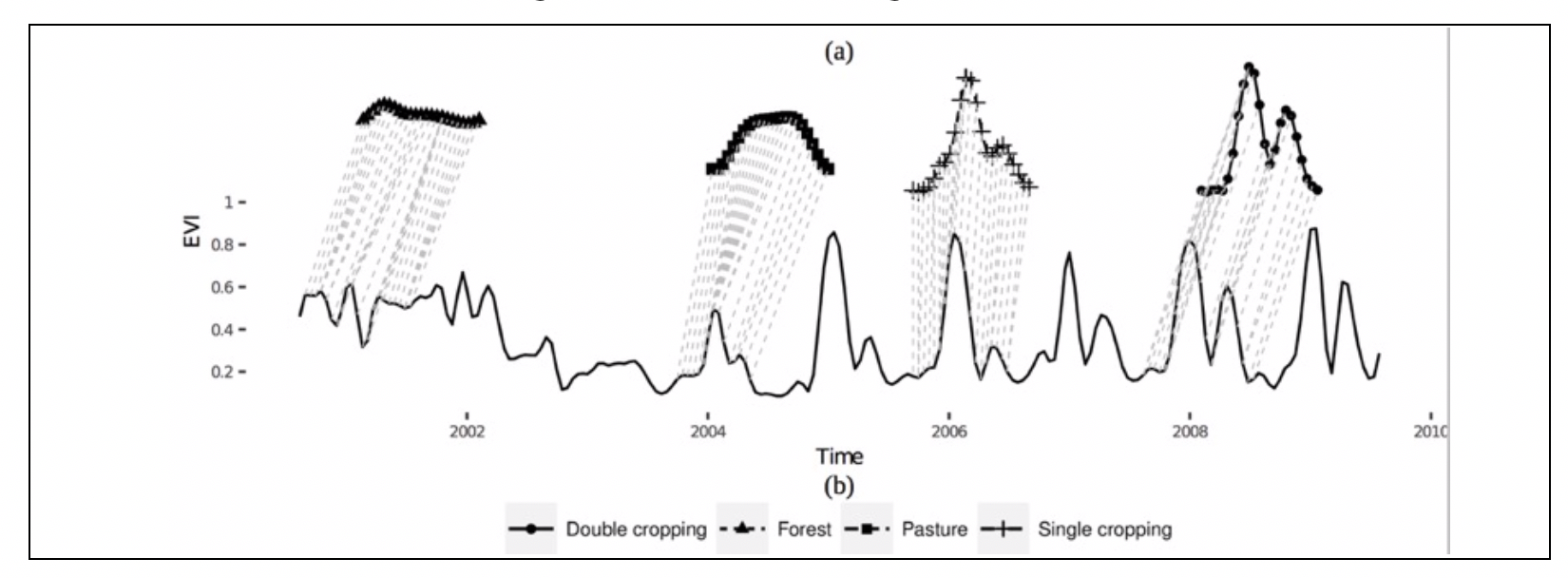
dtwSat paper at Journal of Statistical SoftwareFebruary 2019We published a paper describing the R package for time-weigthed dynamic time warping..." |
|
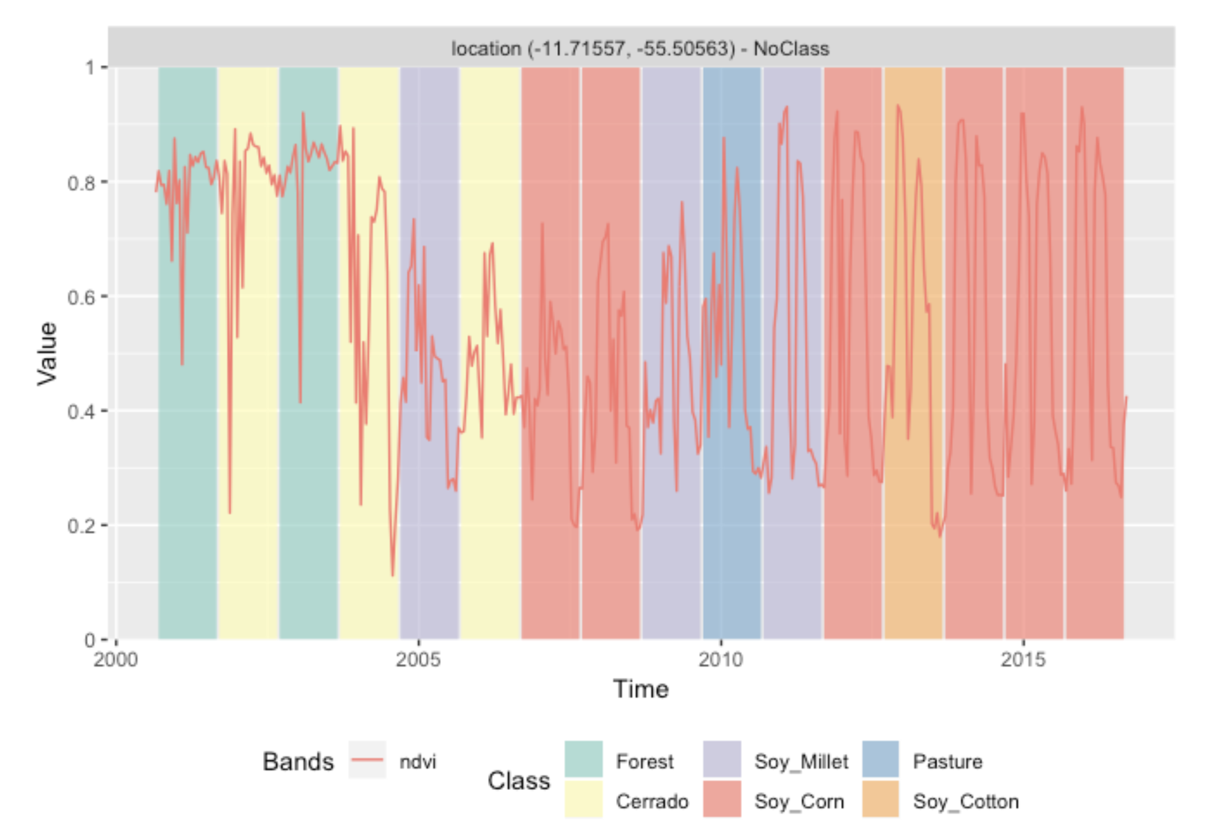
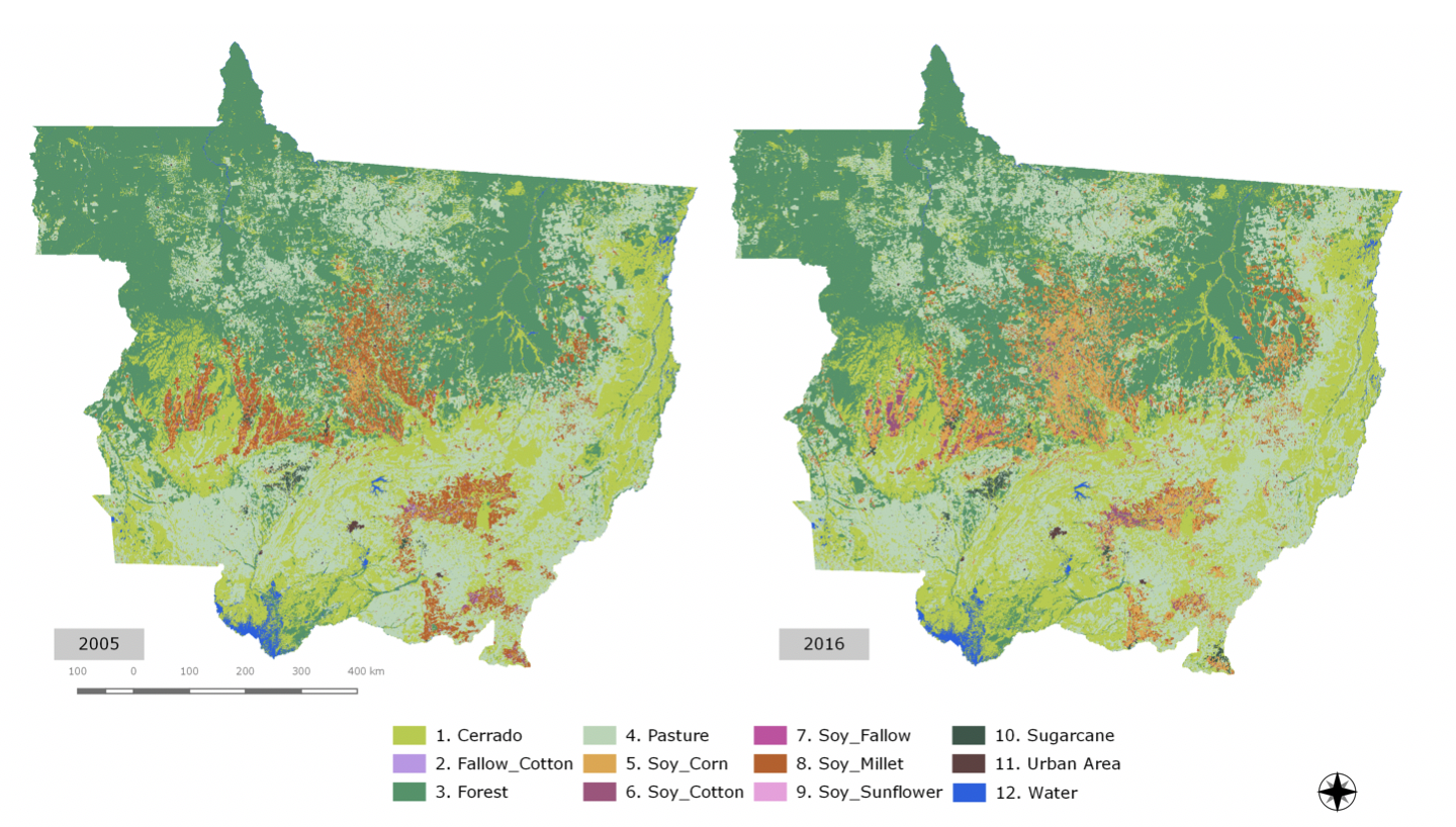
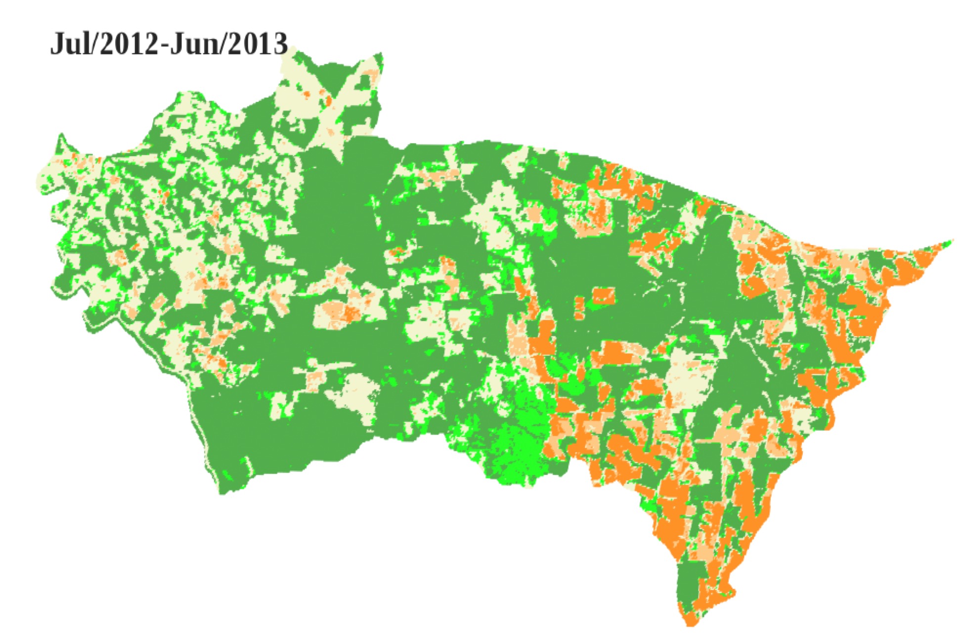
new paper on LUCC classificationNovember 2018The e-sensing team produced a new LUCC for the Mato Grosso state in Brazil from 2001 to 2016..." |
|
Paper published in IEEE JSTARSFebruary 2016We published a paper describing a new method for satellite image time series analysis in IEEE JSTARS..." |
February 2016 |
Paper published in IEEE JSTARS |
December 2015 |
PhD thesis on forest degradation |
December 2015 |
Fellowship holders selected |